


We’re up early, me preparing breakfast and Avery taking down the tent and putting away the sleeping bags and pads. After a meal of fruit, cheese and bread we finish packing and are on the road by 7:30 with about 8 hours and about 480 miles to Spokane, Washington. I say 480 miles but that is according to the map and the shortest route. As usually happens, and since we have a lot of day before us, we’ll probably take some side road. But for now we’re pulling out of the campground and are heading west toward Montana.
It always gives me a feeling of melancholy, leaving such a fantastic place that I’ve become quite comfortable staying in. I don’t want to leave, especially knowing it will be a long time before I return, if at all, but I know we have a schedule to respect. Avery feels the same way but maybe not quite so much – he’s looking forward to a new place to live and I can’t really blame him. Today, however, we’re traveling through western Wyoming, Montana, upper Idaho and will finally cross the Washington state border into Spokane.
Once outside the western entry into the park things change and the commercial world crowded around one of only 4-5 entries to the park is clamoring for attention, even this early in the morning. Luckily we’re through it very quickly and find ourselves once again on highway 191 (we came up through Utah on that road, past Arches National Park) and are glad to find the highway travels for a long distance adjacent to the Gallatin River, and through the Gallatin Mountains. It even dips back into Yellowstone territory so development is minimal. Eventually we open into a valley with farmland and mountains on both sides within a half mile. Soon we’re intersecting Interstate 90 which will take us to Seattle. Gillian and I traveled I-90 several years ago from just outside Chicago through Wisconsin, Minnesota, South Dakata, Montana, Idaho and finally Washington – with a few excursions, of course.
Avery and I turn onto I-90 and decide we’ll be pretty hungry by the time we reach Missoula so we make plans to stop. When we get close enough I look for a part of the city that looks familiar (Gillian and I stayed here before) and since the city is well exposed, being scarce of trees, downhill from the interstate and mostly gathered on the south side of the interstate I recognize a nicely scaled urban area near the university that has some activity on this Sunday morning. We spot a place with a respectable number of cars and head in. Turns out this is a good choice – the food is remarkable and – Avery tells me – the wait staff is easy on the eyes. I take his word for it.
Back on the interstate, which has provided a front-row seat to some spectacular scenery, I realize we’re making great time. I don’t really desire to spend a lot of time in Spokane (no reason to) so I start looking for an excuse to get off the highway and into some wilder and unfamiliar Montana. I get my opportunity when I see a sign for “National Buffalo Range – Flathead Indian Reservation”. That’s all I need so when we get to the exit to highway 93 we take it. North we go to some place I’ve never heard of – and excited to be sharing it with Avery.
We’ve been through a lot of Native American reservations in the USA and Canada, and have gotten lost in nearly all of them, but the really remarkable phenomenon is that the most mundane things – signs, housing and commercial character, even details of roadways – are slightly different making the environment both familiar and oddly unfamiliar at the same time. Even without boundary signs you quickly become aware that things are somehow different. When we were traveling between Burlingtom Vt. And Montreal several years ago Ceil, Gillian, Avery and I found ourselves in unfamiliar surroundings and finally surmised we must be on a reservation. When we eventually ventured into a “town” the signs made very little sense. They certainly were not on a par with the directional and information signs we’ve been used to. And when we saw a (what I assumed to be an official highway sign) diamond shaped sign with a familiar yellow background that had the word “POLICE” above an icon of an ice skate we knew we were not on familiar soil. We never figured what “Police” had to do with “skating” but that sign provided a foil for a long discussion.
Today, on this Flathead reservation, in north-western Montana, the environment is not really that different from what we’ve seen so far but the signage is direct in letting you know this is not the USA. The road signs are printed with English and Salish languages, and the Salish language is a startling combination of mostly consonants – very few vowels. “Salish is most commonly written using the Americanist phonetic notation to account for the various vowels and consonants that do not exist in most modern alphabets.” - Wiki
This reservation and a few more in the Pacific Northwest who speak Salish - or some form of it - take great efforts to save the language for future generations. Obviously they feel placing it in such public locations like public signage will help. Let’s hope so.
Also remarkable, there are overpasses across this and other highways in the region that are for animals only. They steeply cross over the interstate and are intended for the safety of the numerous bear, buffalo, bobcat, elk, antelope, deer, etc.. that need to get across the dangerous roadways. These overpasses came about as a solution to the Montana DOT's desire to widen the roadways due to increased traffic - here to view the landscape and wildlife. The Flathead people, maintaining their respect for all the earth provides, especially their brethren wildlife, rejected a widening because of the dangers to the animal population already threatened by speeders. With the help of a design firm in California they developed the idea of keeping the roadways at current width and number, and building overpasses for wildlife migration. They also contended that increased roadways and widths would not only increase danger to wildlife but would diminish the experience of the travelers. Imagine a wide 4-6 lane interstate relative to the 2 lane highway that now brings tourists to the area. The Flathead Nation made a sensitive, intelligent choice that will ultimately protect what is of real value.
Also remarkable, there are overpasses across this and other highways in the region that are for animals only. They steeply cross over the interstate and are intended for the safety of the numerous bear, buffalo, bobcat, elk, antelope, deer, etc.. that need to get across the dangerous roadways. These overpasses came about as a solution to the Montana DOT's desire to widen the roadways due to increased traffic - here to view the landscape and wildlife. The Flathead people, maintaining their respect for all the earth provides, especially their brethren wildlife, rejected a widening because of the dangers to the animal population already threatened by speeders. With the help of a design firm in California they developed the idea of keeping the roadways at current width and number, and building overpasses for wildlife migration. They also contended that increased roadways and widths would not only increase danger to wildlife but would diminish the experience of the travelers. Imagine a wide 4-6 lane interstate relative to the 2 lane highway that now brings tourists to the area. The Flathead Nation made a sensitive, intelligent choice that will ultimately protect what is of real value.
Something else that is different with the Flathead Nation is the seeming absence of poverty so prevalent on other reservations we’ve seen. It is quite beautiful and a bit wild. When we finally arrive at the National Buffalo Range we’re pleased that it is even simpler than Yellowstone – very few man-made constructions. The paved road that serpentines up the mountainside is wide enough for only one car so there’s no turning around. Once you start you must remain committed to the journey and it is long, but certainly worth it. It is even a bit disconcerting to have no guardrails to prevent driving off the mountain but the pristine view and experience is worth it. Otherwise the overall natural experience would be diminished.
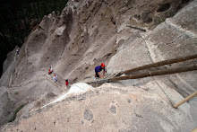
The views of valleys below are spectacular and wild. And the abundance of wildlife certainly justifies the side trip – antelope, deer, buffalo, but no elk. Perhaps they’re farther up in the mountains for the summer. Finally, after shooting numerous photos Ave and I head back toward Idaho and I-90. But it isn’t that easy – the signage, you know. Even though we have a great travel map of the country it seems to have no power here. We can’t make sense of it relative to the reality on the blacktop so we do what any man would do in the situation – wing it and rely on masculine navigation intuition. It makes sense that the road we’re on is roughly parallel to I-90, and can’t be too far north. We’ll simply wait for a substantial road off to the left (south) that is bound to deliver us to the interstate. Not so. We’re on Montana highway 200 in a valley – rock outcroppings, thick forests of Lolo National Forest on both sides, occasional small communities and the ever-present Clark Fork River. We notice an abundance of casual rafters mile after mile on the river and Ave notices there are bubbles surfacing like those on the Madison River in Yellowstone – must have sub-surface thermal emissions as well. Makes for a popular float experience.
Finally we take a promising Montana 471 toward the south but since we’re now in mountainous Lolo National Forest we have a long, scenic, slow journey along some terrific landscapes - and I-90 nowhere to be detected - not a problem. Finally we enter Idaho on Thompson Pass Road and quickly join up with the Coeur D’Alene River winding down the valley and with many rafters in and along the waterway. It seems that when the winter isn’t hosting skiers in this area there is still much to do in the summer. But while there are many people enjoying the river there aren’t many commercial opportunities for gas – actually there aren’t any and we're treacherously low on fuel. Ave and I turn off the air conditioning and go easy on the gas pedal. We’ve been in this situation many times before (bite your tongue, Gillian) and know how to conserve. Soon we find a wreck-of-a-store that has 2 dilapidated pumps with busted faces that don’t post the cost and certainly don’t take pump-side debit cards. We’re in primitive country now but pay the ridiculous price inside for our frugal 3 gallons (we’re cheap but optimistic that we’re actually close to the rendezvous with I-90 and can find more fuel there – which turns out to be the case). It is actually an interesting vernacular experience and we’re relieved to be able to roll out of the wilderness on our own power.
We make it back to the interstate and in no time find ourselves driving through the lake area of Coeur D’Alene, Idaho just before entering Washington State. The day ends as we soon arrive at our Spokane bed&breakfast, shower, have a leisure walk to a local pizza joint for a hot meal and eventually turn in. Tomorrow is our last day on the road and I think Ave is ready to be in his new abode.


No comments:
Post a Comment