Peter & Avery - National Buffalo Range

Peter & Avery - National Buffalo Range

fawn, NBR, Montana

fawn, NBR, Montana

Flathead Nation

Flathead Nation

brawn

brawn

National Buffalo Range

National Buffalo Range

doe... a deer

doe... a deer

grasslands

grasslands

pronghorn

pronghorn

pronghorn

pronghorn

playlist - complete journey


Get a playlist! Standalone player Get Ringtones

Yellowstone Lake

Yellowstone Lake

Yellowstone Lake

Yellowstone Lake

bison

bison

Grand Tetons

Grand Tetons

Yellowstone River

Yellowstone River

grizzly family

grizzly family

flowing lava layer + people

flowing lava layer + people

Mammoth Springs sulfur pool

Mammoth Springs sulfur pool

Mammoth Springs sulfur pool

Mammoth Springs sulfur pool

Mammoth Springs sulfur pool

Mammoth Springs sulfur pool

bear #7

bear #7

Ave @ Sheepeaters Clffs

Ave @ Sheepeaters Clffs

Madison River

Madison River

Madison Campground

Madison Campground

Ave @ Madison River

Ave @ Madison River

Ave @ Madison River

Ave @ Madison River

Madison River

Madison River

Grand Tetons Across Jackson Lake

Grand Tetons Across Jackson Lake

Ave @ Snake River

Ave @ Snake River

lunch @ Snake River, Bridger National Park

lunch @ Snake River, Bridger National Park

Fence @ Idaho/Wyoming border

Fence @ Idaho/Wyoming border

pit stop in Echo Canyon, off I-80

pit stop in Echo Canyon, off I-80

roadway - Arches National Park, Utah

roadway - Arches National Park, Utah

crescent - Arches National Park, Utah

crescent - Arches National Park, Utah

landscape - Arches National Park, Utah

landscape - Arches National Park, Utah

Arches National Park

Arches National Park

on the prairie - Arches National Park, Utah

on the prairie - Arches National Park, Utah

Ave @ Arches National Park

Ave @ Arches National Park

waiting for dusk @ Delicate Arch, Utah

waiting for dusk @ Delicate Arch, Utah

waiting for dusk 2

waiting for dusk 2

Peter

Peter

Delicate Arch + human scale

Delicate Arch + human scale

Sunday, August 29, 2010

Day 6, Yellowstone

Up this morning and the temperature is in the low 40s. Luckily the bathroom has a ceiling heater and I feel like I’m in luxury. I had anticipated the cooler temperatures and both of us had packed accordingly. It is actually comfortable sitting at the picnic table eating yogurt, fresh-cut fruit and juice nearly alone because it is about 6:15am. We’re spending the entire day, and another night, exploring Yellowstone and have decided to get an early start. By 6:30 our campsite is secured and we’re heading south down to the Old Faithful site – Avery’s choice – before the crowds awaken.

I had been reluctant to stop in Yellowstone in July because I was concerned it would be crowded. I had frustrating visions of spending hours behind a line of stopped RVs but that never materialized. The park is so huge that there’s plenty of relative solitude for those who don’t need to stick to the tried-&-true tourist hotspots.

Which brings us to Old Faithful. There’s more development – though low key and pleasantly contextual – here than most other areas of the park. When we learn that the celebrity geyser will next erupt at 9:30 tonight we quickly put that behind us and return to the road and enjoy the ride up past Yellowstone Lake, with the Grand Tetons off in the distance. The air is cool, the water calm and the atmosphere clear. It is beautiful. After spending some time here we are back on the road and quickly encounter a buffalo walking slowly about 20’ off the road. We stop for a close look (but not too close – these beasts attack numerous goobers annually, killing some)  and he seems completely disinterested. Avery likes this.

That buffalo is the first of many we’ll encounter. Usually when you see cars pulled over where there is no formal parking it signals a good opportunity to view wildlife. We soon see such a group of cars and people. We find a parking place up the road and walk back, noticing people gathering on the right shoulder. They’re viewing a mother grizzly and 2 cubs and a ranger is present to direct traffic. I’ve gotten my 200mm lens attached and tell the ranger that I’m going to climb down the hill to within about 20’ of the bears for a better shot. He enjoyed the joke and Avery and I took turns with the camera from the safe distance of the road edge. There are groups of naturalists who, with the rangers, track certain animals, especially with offspring, and can come back day after day with telescopes and long lenses to get good shots. Apparently this grizzly family has remained in this meadow for about a week. I suppose she realizes she has nothing to fear as long as no one tries to approach.

Further down the main loop road we see a similar grouping of viewers and photographers perched on a hill looking off toward a distant meadow where they said they’d been watching a wolf family with several cubs. Since the wolves make use of a den the naturalist know where they’ll be from day to day. They’re too far away for us to see without a telescope but it was very interesting anyway. Off to the right we can see a herd of elk though.

We head up toward Fort Yellowstone in hopes of seeing more elk – up close. We’re ready for lunch also and I remember that they have picnic tables there. On the way we stop twice to photograph several brown bears. Avery starts keeping count of the bears we’ve seen – he’s having a great time.

Gillian and I were at Fort Yellowstone 3 years ago and were surprised to see so many elk lounging between the old officer’s housing, unconcerned with the people milling about. We were there in the fall and the elk are forced to come to lower elevations where the snow hasn’t yet covered the grass. Avery and I are here in the middle of summer and only 2 doe elk are resting in the grass. It is still a fascinating place with well-preserved (and seemingly still inhabited) late 19th century structures that housed the soldiers from the Calvary’s Company M that President Teddy Roosevelt sent to keep the park clear of poachers, squatters, souvenir hunters,  etc. who threatened to destroy the newly declared treasure. The wood-sided officer’s quarters are rather large, similar to the 2-level foursquare typology popular at the time, the enlisted men’s cottages are smaller though no less interesting in scale and detail. They seem to be based on the traditional farmhouse with ample porches facing the public green. Other buildings of note are the post office, the stone Engineer’s Building, stables, etc.

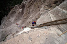
After our pleasant picnic (there was a very attentive magpie who seemed to spend a lot of time around our table) we photograph some of the buildings and then head south toward Mammoth Hot Springs – which is actually adjacent to Fort Yellowstone and is visible from the community. The main geological interest is a huge mountain/wall of sulfur and other mineral deposits that have flowed down the vertical faces of the cliffs, from the flattened top where the pools are. This place is spectacular – just look at the photos.

Later in the day I decide to take a small side road - Blacktail Plateau Road (too fancy a word for an 8’ wide gravel, pocked path) off to the left in hopes of getting even further into the wild park. I had seen some of these paths, which are marked with signage, on my Google Earth research. You can get a pretty good idea of what an area looks like via the photos people post on G.E.. I thought this was a good move but soon realized that the road was quite rough and, being a one-lane path with no turn-offs and cars off in the distance behind us we are here on this path until it finally joins a paved road. That’s fine. We simply drive very slowly and get a good idea of what real natural wilderness looks like. And there are some spectacular views because the path goes up to, and follows a long ridgeline. Eventually we come to a stop (because all the cars in front of us do) and discover another black bear foraging, unconcerned, in the brush. We spend a lot of time watching him before we finish out the path.

When we return to the Madison Campground late in the evening a ranger is notifying each site that a grizzly is pacing the parameter of the campground and we should all be aware, and should make sure our food is locked in the provided steel boxes or the car. There are rangers at the parameter discouraging the bear from entering and soon we hear a helicopter, which I assume, is aiding in turning the bear away. The park personnel have already warned us that if a bear comes into the campground and accesses any food that has been left out they’ll have to put the animal down because he otherwise will continue to come to where people are to get food. I’m not sure if they’d really destroy the animal but is seems plausible and I’d hate to be responsible for that tragedy. So we secure our food very well.

Since it’s our last night in Madison we go out by the rivers edge after dinner (hot dogs supreme) to hang out. This really is a special place. River is flowing at a good pace but is not deep enough to be a threat. I wade out into the water far enough to confirm it is frigid. Avery notices a tributary that comes off the main body, and it has bubbles rising. He surmises that they are resulting from the same source that supplies the geysers and posits that the water must be warmer. My boy’s a genius. I tepidly step into that pool and it’s like bath water. I hang out in the warm water for a while as the sun goes down and finally we head back to camp. We’ll have an early rise tomorrow so we can make it to Spokane by nightfall.


Sunday, August 22, 2010

Day 5 - Utah to Yellowstone


Up early, breakfast eaten, cooler filled with ice from the hallway icemaker and the car filled with our 7th tank of gas – all by 8:15 – and we’re on our way to Yellowstone. We take highway 89/6 through the tan, rocky Utah landscape in anticipation of the 500 mile, 9 hour drive. While the high rocky cliffs on both sides are similar to those in New Mexico they’ve melded into an almost continuous feature and the highway seems to be squeezing its needs from scant opportunities between the rock. And so it goes until we reach the multi-city density that makes up the Salt Lake City metropolitan area – packed with chaotic commercial groupings and characterless stucco-clad suburban tracts all competing for available land between these steep mountains. We are relieved to make the turn onto interstate 80 east toward Evanston, Wyoming and away from Salt Lake City.

On I-80 we start a slight but steady climb from Salt Lake’s average 4300 feet elevation and enjoy the relative solitude. Echo Canyon is especially beautiful, with steep cliffs of stratified rock with more red than we’d seen earlier in the day. Within an hour we’re seeing the landscape change from red/tan to shades of green, signaling higher elevations and, of course, a new state – Wyoming. Once in Evanston we head north on 89/16 which seems to follow a fertile valley bottom with mountains off in the distance. This road snakes west back into northern Utah, back into Wyoming, eventually west into Idaho and finally back into Wyoming where we eventually enter Bridger National Forest where we share the available space with Snake River. By this time we’ve left the expansive meadows friendly to cattle habitat and are now among mountains, thickened conifers and cooler temperatures. We’re both hungry and look for a turn off to have lunch next to the river. We finally find one where horse trailers are not allowed (we’ve seen many riders and their vehicles) and the small parking lot will not accommodate rafting trailers (the Snake River has great rapids and the previous 2 turnoffs were filled with large groups of shirtless revelers). There’s no one here and access to the shallow river is wide. We relax, make sandwiches with the last of our provisions and simply hang out for a while – we’ve made good distance and have plenty of time to get to Madison Campground with ample daylight.

Fed and rested we hit the road, stop in Jackson for additional gas and enough food to last a couple more days. Densely packed Jackson is buzzing with tourists. Obviously an upscale destination it is almost Disney-esque with a pioneer theme – saloons, western wear stores and animal-themed restaurants. While everything is clean and crisp it is also artificial and we can’t wait to get out. Luckily Jackson and its environs are surrounded by National forests and at the edge of what is a tight “city limits” we’re in Grand Teton National Park/National Elk Refuge. The immediate landscape is flat meadowland with a mild, wide Flat Creek reflecting the snow-capped Grand Tetons off in the distance. Aaaaahhhhh.

I’ve driven this route before, with Gillian, and it is no less impressive this time. Driving along this open valley with blue/purple mountains in the distance is a perfect approach to the south entry to Yellowstone and within an hour we’re making the turn into the park, amid the thick conifer forest, and stop by the roadside to view a female moose drinking in the river. Naturally I fumble with my camera, trying to changes lenses for a 200mm and by that time the moose has returned to shore and disappeared immediately into the tall grass. We’re both very happy to be here and within another hour we’ve arrived at Madison Campground, gathered our firewood and set the tent. After a dinner of hot dogs and chips (we are primitive with no cooking equipment except what we fashion from sticks) we spend the remainder of the evening sitting on the bank of Madison River – a slow, wide and shallow river across which beautiful mountains and a thick stand of fir trees that are situated to reflect the setting western sun. They seem to be supernaturally illuminated – bright green – against a backdrop and foreground of muted landscape due to a lack of the same light. Gillian and I sat on this same bank marveling at the calm beauty just 3 years ago. A great place to hang out with your kids…..

With a low temperature of the high 30s/low 40s we hang out until the sun is completely gone and finally hit the sack, anticipating an early day tomorrow where Avery will be on the prowl for wild animals.

Tuesday, August 10, 2010

Day 4 - Santa Fe to upper Utah


This morning I’m up at 6:30 to spend some time with our hosts and other guests before we return to the road. The governing issues today are 480 miles over an estimated 9 hours, and the need for a new set of tires. Late yesterday afternoon we gathered the great minds together and inspected Avery's tires. I had promised him a new set for a graduation present but had hoped to squeeze an entire cross-country trip out of the rubber before us. Consensus: these tires must go, so we planned to drive to Albuquerque's Costco this morning, get the tires and be on our way. We choose a national retailer in case something happens to the tires along the way - we want to be covered under warranty.

As big box retailers are almost always located in a suburban sea of homogenous clutter we abhor having to wait here (there's nowhere to walk to – we’re trapped) to get the car back. We long to be away from the offensive generic landscape that one finds in every large city in every state in the country. Again with Stein's "there's no there, there". Finally at 12:30 in the afternoon we've got Albuquerque in the rear-view mirror and make some headway. We head north on highway 550 through the New Mexico desert, a little concerned that with a 9 hour drive we may not make it to Canyonland National Park before sunset. Alas, one of our tenants for the trip is to simply "make some plans but don’t be controlled by them".

We have riding with us today a quiet and fresh confidence that I always experience with a new set of tires. We're content. Avery takes control of the tunes and I'm surprised to have to admit that I enjoy his playlist more than the one I spent 2 weeks accumulating. I bought about 11 new albums and although all the artists are new to me they fall into a very narrow category that I'm used to . On the other hand Avery's music - though I wouldn't have chosen it during my recent search, due to its unfamiliarity -  has been immensely refreshing and richly complimentary to our new surroundings. We listen to DeVotchKa while we make our way north through an expansive, mostly uninhabited landscape of rolling desert, mesas and steep cliffs, sometimes on both sides of the highway.  It is spectacular.

The route we’ve chosen will take us past the town of Farmington, the economic center of that part of New Mexico. While the basic natural landscape doesn’t change much the area’s juxtaposition of unchecked human sprawl, certain lack of planning where heavy industrial installations can be located adjacent to convenience stores, and a general cacophony of building types, uses, scale, placement, etc., make the combined landscape seem harsh and unwelcoming. Certainly the quality of life here is nothing like that of Santa Fe, where critical planning governs. I remember commenting to Roger yesterday about the pleasant scale of the buildings in Santa Fe. Even a retail center I observed that had low roofs, a scale compatible with its various neighbors, and minimal and thoughtful signage that was both attractive and contextual. Roger said that the city has strict design planning requirements – and it apparently pays great dividends. The built structures there are wonderfully integrated and compatible with the natural landscape of Santa Fe – consider low,  flat-topped, earth-colored structures amid a like-colored, mesa populated landscape…..fantastic.

Not so with this area of New Mexico but we’re soon out of the inhabited areas and back in the desert where, true to our experiences, we encounter a new landscape as we clip the southwestern corner of Colorado. Almost immediately we’re in a lush, green valley with small farms and rivers. It reminds me of the Shenandoah Valley of western Virginia but only in land form. The plant species are, of course, noticeably different but there’s a new color introduced here that we haven’t seen yet – a medium sage green common to many of the small (3-4 feet tall) shrubs that when seen en mass, and in front of larger, darker plants is quite vivid.

The rolling, green landscape in most of this area of Colorado gives way, subtly, to hills that begin to expose their rock substrate as we near the border and as we cross into Utah the green gives way to high desert where the predominant material is rock, the color reddish-brown and the forms truly unique and expressive - and massive. This is our 7th border crossing and we are awe-struck. We take highway 491 west to Monticello and from there travel 191 north. The scenery doesn’t diminish in it’s spiritual aura the entire way to Moab but as we approach the turn-off to Canyonlands National Park we realize that our late start this morning, and missing out turn at Farmington, has cost us precious time and we’re running out of daylight. I had planned on stopping at Canyonlands because I’d seen many different landscapes where geological eruptions or massive erosions left protruding objects in the landscape, but I hadn’t really seen vast canyons. On the other hand, as my son, the recent graduate posited, much of the canyons will be in shadow and poorly illuminated, and the monumental rock formations at Arches National Park, on the right side of 191, will be much more visible. That’s my boy.

Actually, this is the first instance on our journey of Avery expressing a choice, because he had wanted to be kept unaware of our itinerary. He didn’t want to know where we’d be traveling so he’d be surprised. Its not my way but it seemed to be how he wanted to cross-navigate the country. But yesterday evening I had to reveal my travel plans when I pondered the option of 1. Staying in Santa Fe to attend the panel discussion, meaning eventually driving a 14-hour day through central Colorado and into Wyoming to get to my reservation at Yellowstone, or 2. Take the Utah route and break the distance into 2 parts. Let’s see…attend an event for which he had no interest, and then drive like hell, or casually traverse the most unique landscape he’d ever seen. So here we are taking a right into Arches National Park.

It is about 6:40 pm, we’re loosing sunlight, and the park gate is unattended –the sign states “open until 6:30”. Does that mean the park closes, or the ticket office closes at 6:30. Not clear but the gate is wide open. We decide its worth the risk of getting a trespassing ticket and drive on in. We realize we’re, by far, not the only ones continuing to enter the park and, after a few stops at fantastic rock formations realize that this is the perfect time to be here and the gates were left open intentionally. The red rock formations are being energized by the low western sun. They begin to glow – and there are so many of them. Different forms, sizes, groupings. Some are impossible stacks, some form caves or framed openings, some are mesas and some continuous cliffs. Some seem to be coarse, roughly defined beings marching, as a group, in the same direction, with a singular and resolved intention. And those are just the ones we’ve seen in the first 45 minutes. According to the map this park is huge.

We see a sign for “Delicate Arch” and figure we’ll take that turn-off and, realizing the parking lot is almost full, this must be worth a hike. We take off on foot not really knowing where or how far, just walking in the direction of everyone else. Actually, this is a perfect time to be outside in the desert, the sun going down and the temperature suitable for a hike that takes us on a 3 miles round trip, and 485 feet of assent. I stop a few times, uh, to let Avery rest….

We arrive at the spectacle just before the sun fully illuminates the formations and I now know why so many enter the park at this time of day, and why so many make this moderately difficult journey.  I have no more words, just look at the photos…..

As Ave and I sit here enjoying the views, of the formations immediately before us as well as those off in the distance at consecutive intervals of space, I wonder how many humans have done the same thing in the past 15,000 years, equally awed. And this is just a small part of the vast park. This is truly a spiritual place. Anyone who thinks federal government is of little use to the interests of the people should consider the likely fate of this and other national treasures if the land hadn’t been conserved, natural and uncommercialized, for “all the people”. Consider this pristine, public gem compared to the highly compromised, commercial Niagra Falls. I, for one, am thankful for this opportunity – and I’ll certainly return.

After about 45 minutes we decide to leave the large, varied crowd (where we heard at least 6 different languages) and get an early start back so our walk will be unhurried and uncrowded. We still had enough light for some photos and, using Avery for scale I click away. He jokes that due to his photogenic qualities the photos will lead to a barrage of modeling offers. As we walk on, alone from the crowds we left behind, we continue the sarcastic banter until I say “you’re so wonderful I think I’ll get a tattoo that says ‘son’’. To which Ave responded, “I’ll get a tattoo that says Dad if you get one that says ‘Son”. He sounded serious and though I don’t think I’ll really ink my body, and will never really know if he was serious, I certainly appreciate the gesture. Taking the turn into this park was absolutely the right choice.

We enjoy the hike back to the car, arriving with little light to spare and eventually snake our way in the dark back to the park’s entrance. We encounter many cars along the drive who continue to enter the park, and though we’d like to stay we have another hour-and-a-half drive to Price, Utah. The drive is tiring but the time we spend driving tonight is time we’ll be able to spend in Yellowstone tomorrow.

Sunday, August 8, 2010

Day 3 - Hanging Around Santa Fe

Late last night we arrived at Roger and Mary Anne’s home overlooking Santa Fe. They were already housing 2 other guests, Stephanie Taylor, (art history professor) and friend David Taylor http://www.dtaylorphoto.com/ who were in town to celebrate David’s new book of photographs on the very timely subject of immigration along the southern border - "Working The Line".


This beautiful book of poignant photographs + text includes a companion foldout document illustrating physical markers delineating the border line between the US and Mexico. These markers of varying design (though all based on an obelisque) were constructed of masonry, stucco or cast iron and were placed such that one can always view the next in succession so as to confirm the actual line where one country begins and the other ceases. In general the book’s photographs, which I think David worked on for 5 years (he continues to photograph the markers- there are many) are at the same time extraordinarily beautiful and ordinary – and very thought-provoking without presenting a particular argument on the subject.


Impressed, yet tired, I hit the sack.

Our 3rd day, to be spent around the Santa Fe area starts early with a refreshing, cool smoothie consumed on Roger’s terrace overlooking the city.  The weather is cool -  something I didn’t expect, but packed for. I have my breakfast in solitude except for the close, affectionate attention of Jasper and Holly. Ave is still asleep, Stephanie hasn’t risen yet, Roger is inside, and David and Mary Ann have already left for a radio interview at Albuquerque’s public radio station. They will be discussing the book, and its place within the context of the current debate on immigration. There will be a panel discussion tomorrow but we’ll be somewhere in Utah, thinking about less heady topics. David and Mary Ann’s interview this morning goes quite well.

When Avery finally rises we discuss the many options available to us - these are numerous – and we settle on visiting the Bandolier cliff dwellings. A quick Google Maps review and we’re offered a northern route – but wait, there’s a southern route that seems closer to our base. There we go and I eventually note the first time I’ve been misled by my old companion, the map site. After driving about an hour (through beautiful but semi-barren hills), and experiencing some very impressive vistas the roads take us through a Native American reservation, and becomes confusing and narrower until finally the “road” has morphed into a donkey trail (for only fit and agile donkeys). When we confirm our mistake with a local tribal official at the park center we head back toward Santa Fe and pick up the northern route. Since we’re in no hurry we chalk it up to an imperfect internet mapping system. And the views have been cathartic.

I’d planned to view Ancestral Pueblo dwellings, or remnants of them, on this trip and thought Bandolier National Monument would be a perfect opportunity. Otherwise we would be stopping while we’re on a day’s distance journey and time would be a controlling factor. Not so today and I count myself fortunate.

Artifacts like Bandolier reflect a building history dating from 1150 until the mid 1500s, when the Ancestral Pueblo people relocated and left their structures for the elements to reclaim. Luckily there remains enough to transform us to another time and culture.  What is especially exciting are the regularly arranged holes in the side of the volcanic tuff cliff-face that reveal where the joists and rafters were supported. Each regular sequence of holes delineate the width of a particular volume (about10-15 feet maximum is my guess) and  how many volumes are stacked – sometimes two and sometimes three, always sharing constructed walls. These are certainly among this continent’s earliest urban communities.

These groups of holes also reveal that these dwelling cubes were probably not much taller than about 7’ – 8’.  That, along with the floor area tells us that living quarters were tight. And there are many instances where the soft volcanic tuff wall, providing one edge to the dwelling, was carved out to expand living space. While this cliff has natural cavities it is clear that many were expanded, or made anew, to accommodate habitation. What is really remarkable is the size of some of these “caves”. One we looked into was large enough for only 3-4 people, sitting upright, and around a fire (as evidenced by a blackened ceiling). That’s close, and most other dugouts were about the same size or smaller. In addition, some of these carved out volumes had remnants of decorative applications, still visible.

There are other decorations faintly visible on the cliff walls that are either applied (some sort of colored paste) or carved into the cliff-face. We could discern numerous petroglyphs - simple geometric patterns, un-representative though certainly man-made forms, and easily recognisable natural images such as a birds and faces - http://swcenter.fortlewis.edu/inventory/BandRock.htm. As if these aren’t fascinating enough, they occur at locations that were clearly within the living volume, as evidenced by the structural sequence of holes, but also above where those holes indicate a roof, meaning a less-personal gesture that would be visible to others – either tribesmen or enemies. By the way, Pueblo entrances are through the roof, making it very risky for an enemy to enter the structure.

It is often these types of ruins are attributed to both the “Anasazi” and “Pueblo” - at least within my limited knowledge. We encountered a volunteer park agent, around 80 years old,  hiking the remains, who offered to answer any questions we had. When asked why one of these names became the other she informed us that "Pueblo" was the name accepted by the inhabitants but "Anasazi" was the name given by the Navajo people, meaning “enemy”. Very telling….

In addition to the cliff dwellings there is also present a crescent-shaped settlement artifact (referred to as Tyuonyi Pueblo) on relatively flat ground where foundations still remain. The crescent foundation is typically 3-to-6 rooms deep without any visible openings between the volumes. Our volunteer ranger informs us that these forms are the foundation volumes and were used for storage, accessed from the rooms above, which commonly rose to 3 stories, encompasing about 400 rooms total.  These original structures were also accessed from the roof, making them more secure. The general community of about 100 inhabitants used the open space formed by this 3-story structure communally, and an included sub-grade kiva (covered, recessed cylinder with fireplace to one side) was used for more formal ceremonies. All together these structures form a very rich artifact hinting at a culture that moved on 500 years ago, but whose spiritual presence is still very palpable.

Avery has been very patient to let me take my time here but we are expected back at Roger’s, where Mary Ann is hosting a dinner gathering to celebrate David Taylor’s new photographic book. The party is low-key and we are able to meet those responsible for this beautiful document: Publishers Darius Himes and David Skolkin of Santa Fe’s Radius Books (http://radiusbooks.org),  Hannah Frieser, of New York, one of the essayists for the book and, of course David and colleague Stephanie. The evening includes a discussion of the current immigration debate but ultimately concludes with a lively enumeration on which cartoon characters worked for either of Hanna Barbara, Looney Tunes,  or the Rocky and Bullwinkle group. Heady stuff….but we have a travel day tomorrow so off to bed.

Wednesday, August 4, 2010

Day two - Van Buren to Santa Fe

Leaving the hotel in Van Buren, Arkansas, and filling up with our 3rd tank of gas we head westward. 15 minutes later we're in Oklahoma and already the landscape is changing. The trees are not nearly as tall as those we had seen in the Ozarks and along the previous day's path. It really is amazing how landscapes change so noticeably at some state borders - obviously a borderline born of geography/geology rather than some political or other less physical reason.

Soon the trees begin to cease almost entirely, being replaced with low scrub and ever-expanding horizons and more large farming tracts. Generally the land is slightly rolling but with such extensive horizons the grade changes seem minor almost to the point of appearing nearly flat. And so it goes until we reach Oklahoma City, remaining glued to Interstate 40. By the time we reach the capitol it seems that the old slogan for the state - "Oklahoma is OK" (eh, not bad; could be better; shrug + wadda gonna do?) -  was genuinely applicable. Even after OK City we see little to impress, except the subtle appearance of old Route 66 remnants off to the right. Actually it looks more like a tired service road but after being "de-commissioned" as a major thoroughfare back in the 80s the commercial interests are milking the nostalgia as best they can and there is a lot of signage referencing the roadway and remaining buildings (dilapidated gas stations, garages, hotels. etc.) that can be seen along the way. What's most remarkable about these structures is the small scale, especially given the wide-open landscape. As we travel on into Texas and New Mexico we realize that the scale and general simplicity of these structures are as much a part of the Route 66 experience as the road itself, which, being as close as 40' (to I-40) in some places, and having virtually no vehicles on it, seems like a puppy following us, not really wanting to be noticed. But the commercial exploitation makes it hard to miss.

As we make our way toward the Oklahoma/Texas border the land is getting a bit harsher with very few "trees" - those which are there are obviously quite lonely and displaying no such strength as the great hardwoods of the east. Besides the now-smaller brush amongst even vaster horizons we notice a rusty oil derrick now and then but they aren't the image of industrial might and mass I had imagined - and as I suspect exist elsewhere in the southwest. These specimens are small, move very slowly and seem incidental to ordinary farm life - as if they were forgotten from an earlier time. As a contrast to this relic of the past we gladly noticed several wind-farms off in the distance, with as many as 20-30 individual turbines. It looks like progress to me. . Go Oklahoma - maybe you don't have to settle for "OK".


So far Texas has the most unique welcome center. Billowing, welded steel structures over nicely delineated personal picnic tables frame a beautiful view away from the interstate and off into the rolling, semi-barren landscape. Even the main welcome center prepares such a view with a landscape-focused pedestrian platform. This fresh design for a real welcome experience is surprising coming from a backward-looking state whose politicians continue to question such givens as human rights, social responsibility, separation of church and state, gravity, etc..….anyway…

The basic landscape of Texas's panhandle seems more severe than that of Oklahoma with larger tracts of land and less vegetation. I can't but wonder how difficult and lonesome it must have been for the early settlers. Minimal protection from the elements, little food/water to forage and nowhere to hide from potential hostile native people. A wagon could be seen for miles - the isolation and vulnerability must have been very stressful. Not so for us in our air-conditioned red rocket –  and we had good tunes to keep us company.

An hour or so later, around lunchtime we decided to abandon I-40 for a calmer place to have a picnic, and to experience a closer look at the new rural landscape. We randomly chose a road off to the right and started down a very straight 2-lane road (turns out the road travels straight for 12 miles). We discovered that much of the Texas panhandle (maybe most of Texas) is fenced off as ranches… private property….don't even think about it. The roads branching off this 2-lane had names like "Ranch Road 1321, or, for variety, Ranch Road 3473/Farm To Market Rd 2473". After about 5 instances of "maybe we’ll find something over the next hill" we became concerned about gas and turned around. (I should point out at this time that in the southwest there aren't gas stations at every other overpass - there aren't really that many overpasses so there are no refueling opportunities off in the range country of Texas). We did, however, find a dirt road that wasn't immediately gated as were the others and set up a restful lunch under a stand of renegade trees and enjoyed the quietest meal of the trip so far - only occasional birds chirping and lightly rustling leaves – and no people - aaaahhhh.

Oh. And as for Amarillo, Texas, the only large city we actually drove into in search of an after-meal peach milkshake (which we never found despite all the teasing billboards - curses) I will quote Gertrude Stein by writing "There's no there, there". It was like any other chaotic, franchise-filled city you'll find outside normal historic centers – of which there didn’t seem to be one here. We saw nothing to reveal a sense of the past except several huge stock pens that betrayed the area's only claim-to-fame – a good portion of the US beef supply comes through those stockyards and rail yards.

And although we saw very few cattle outside these pens along our route we did start noticing small herds of antelope along the fenced-in interstate corridor - Avery's first look at unfamiliar animals and a prelude to what we'll see in the upper mid-west. But for now we're approaching New Mexico where the landscape once again changes and even the physical adobe border marker is unique and welcomes us to the "Land of Enchantment". Ave and I joke that that's a tall claim, especially since Oklahoma merely expects you'll find their state "OK". We'll find New Mexico’s slogan is no exaggeration.

When I plan trips like this one I prefer to make steady headway for a day or two at a time so I can relax and take time to explore certain locations along the way. I had decided to breeze past NC, Tennessee, Arkansas, Oklahoma and Texas by traveling 1700 miles in 27 hours.  I anticipated that New Mexico (where I was born 53 years ago – yes, in 1957 and in Roswell – and please, no celestial alien references) would be worth the marathon and I was correct. This is truly a unique landscape with purple mountains off in the distance and rolling expanses of prairie punctuated with huge mesas that animate the view. Upon seeing these land masses in shadow and light I realize that is the biggest difference between now and what we’d seen before. The basic landscapes of Oklahoma and Texas are similar to the NM horizons but those two previous landscapes had no significant natural shadows. Wow, what a difference.

As the sun starts to go down we make it to the last stretch of road – highway 285. Desolate from I-40 to Roger’s home in the hills above, and looking out onto the lights of Santa Fe – the landscape encourages us to feel as if we had metaphysically covered quite a bit of ground. There is certainly a “there, there”. As we drive along 285 there are very few references of anything man-made – just fences, dirt roads with embedded cattle guards, plus mesas and mountains. By the time we turn off to finish the day at Roger's the sun has rested behind the distant mountains and the orange glow that had silhouetted one particular peak turns to a strong neon blue/purple…..We aren’t in Kansas anymore.

Finally we’re in the home of Roger (woodworker) and his partner, Mary Ann (curator), along with their dogs Jasper and Holly, and a couple other house guests. As we relax on the terrace, drink in hand and overlooking the twinkle of Santa Fe Avery comments that it’s great to finally “be somewhere”.  I agree. This land really is enchanting.

Tuesday, August 3, 2010

Peter & Avery leave Charlotte

OK. My brother, Brian, asked if I intended to blog about my cross-country driving trip with Avery. I think that's a good idea since I had such a good time driving with my daughter, Gillian, across the northern part of the US and Canada 3 years ago. Avery is moving to Seattle to seek his destiny in game-design, having just completed his degree at SCAD. Here goes...

Day uno: we left Charlotte at 6:15am with the intention of driving a marathon to make it to Van Buren, Arkansas - nowhere to speak of, just half way to Santa Fe. Along with Avery’s abbreviated possessions stuffed into his little red Civic coupe we packed a cooler with 2 days rations so we wouldn’t have to take time finding acceptable food, and certainly wanted to avoid drive-in semi-food.

Driving along I-40 through the North Carolina and Tennessee mountains we encountered consecutive rain storms all day, all the way to western Arkansas. As chance would have it the first day of my trip with Gillian, 3 years ago, was completely consumed with rainstorms as we drove across southern Ontario and Quebec Provinces. Very appropriate parallel…

On the first day with Avery we had 2 stops to make, one fruitful and the other not. The first stop was in Lebanon, Tn, to drop in on my old high school friend Anthony Tart. Alas, he was away on vacation. I hadn't notified him (I hate to commit - prefer to leave things open-ended) so he wasn't expecting us. I scribbled a note the receptionist assured me he would receive. Did he get it? Let me know AT.

Next stop was in Nashville at Joe Glaser's instrument repair business to drop off a new Lowden acoustic that was giving me some tonal problems on the low "e" string. I had contacted George Lowden in Ireland and he said if the problem could be discerned Joe was the guy to do it. Luckily I was driving by within a mile or so of his shop and had planned to drop the guitar off. I felt very odd just handing the instrument to a guy I'd never met, 7 hours from home but I discussed my needs, handed it over, got in the car and drove toward Arkansas. More rain followed but there was intermittent calm, at least enough for us to notice changes in landscape. 


Eastern Tennessee is very much like western NC - very lush, rolling hills and mountains. In western Tennessee, toward Memphis the mountains turn to pleasant rolling farmland with occasional low mountains. However, upon passing around hilly Memphis we crossed the Mississippi River at the Arkansas border and discovered that the Great Mississippi divided two very different landscapes. In Arkansas the land turned immediately to flat, expansive delta with large expanses of fields, the scale of which dwarfs those we're used to near Charlotte. The character of landscape eventually changed to hilly, smaller farmland and eventually to mountainous Ozarks as we approached the Oklahoma/Arkansas border. Arriving late we didn't have time to explore the town, and were told by the receptionist at the hotel that there wasn't much to see, that most every historic building had been replaced with newer, characterless structures. We turned in early in anticipation of an early morning departure to cross Oklahoma, Texas, and on into New Mexico. No pictures yet because these are distance days. More tomorrow.....

Bandolier National Park - joist holes

Bandolier National Park - joist holes

ancestral markings

ancestral markings

Bandolier National Monument

Bandolier National Monument

cliffs

cliffs

local

local

Tyuonyi Pueblo-segment

Tyuonyi Pueblo-segment

heated game of scrabble

heated game of scrabble
clockwise from left: David Taylor, David Skolkin, Stephanie Taylor, Avery Tart, Darius Himes & Hannah Frieser

sun sets on the marathon

sun sets on the marathon

Ave on NM285

Ave on NM285

New Mexico 285

New Mexico 285

Route 66

Route 66

Route 66 gas station

Route 66 gas station

Lowden dropped off in Nashville

Lowden dropped off in Nashville